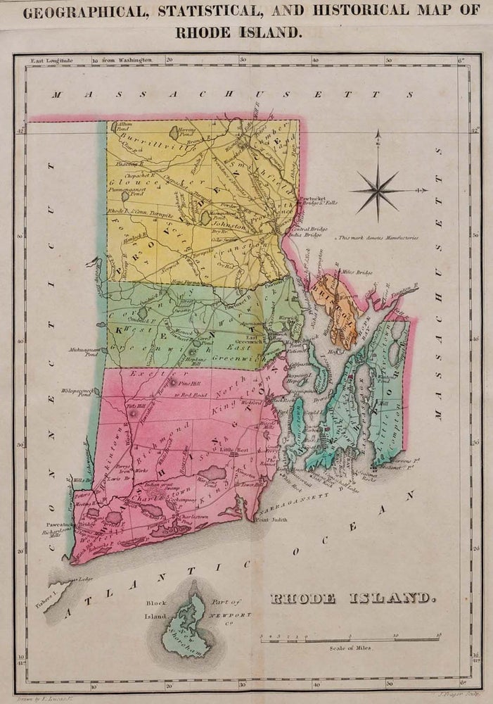
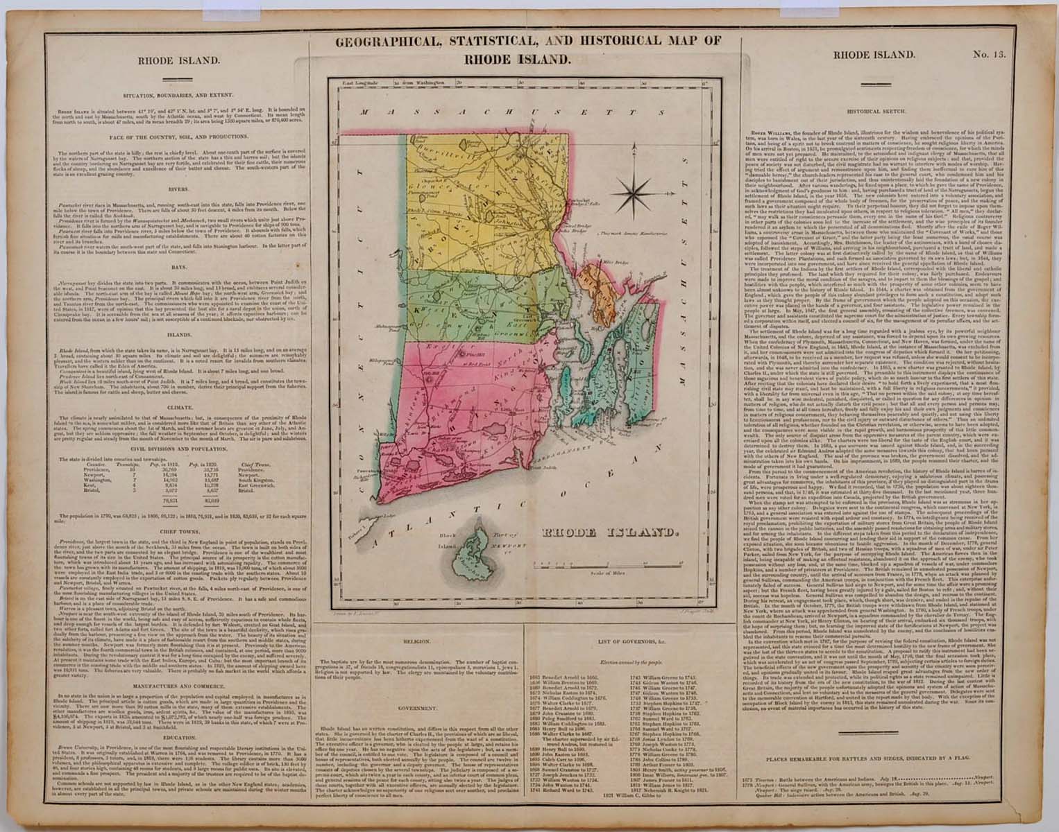
GEOGRAPHICAL, STATISTICAL, AND HISTORICAL MAP OF RHODE ISLAND.
Philadelphia, PA: Carey & Lea, 1822. First Edition. Unbound. Very good+ condition. Item #005196
22.25" (width) x 17.5" (height) printed sheet, with 8.25" x 11.25" hand-colored map near center of sheet (five color). Excellent condition, except for slight browning to center fold, which is offsetting from original glue from reverse hinge. Minor browning to margins of sheet, easily framed out. An attractive image, suitable for office/library display or gift. Originally bound in an atlas titled "A Complete Historical, Chronological, and Geographical Atlas, Being A Guide to the History of North and South America, and the West Indies: Exhibiting an Accurate Account of the Discovery, Settlement, and Progress of their Various Kingdoms, States, Provinces, &c. Together with Wars, Celebrated Battles, and Remarkable Events, to the Year 1822. According to the Plan of LeSage's Atlas, and Intended as a Companion to Lavoisne's Improvement of that Celebrated Work." Americana.
Price: $300.00