![Item #016789 Karte von den N.W. Amerikanischen und N.Oe. Asiatischen Kusten, nach den Untersuchungen des Kapit: Cook in den Jah: 1778 und 1779. entworfen von Heinrich Roberts Lieut. [map]. F. A. Schraembl.](https://kurtgippert.cdn.bibliopolis.com/pictures/016789_1.jpg?width=768&height=1000&fit=bounds&auto=webp&v=1485821553)
![Karte von den N.W. Amerikanischen und N.Oe. Asiatischen Kusten, nach den Untersuchungen des Kapit: Cook in den Jah: 1778 und 1779. entworfen von Heinrich Roberts Lieut. [map]](https://kurtgippert.cdn.bibliopolis.com/pictures/016789_2.jpg?auto=webp&v=1485821553)
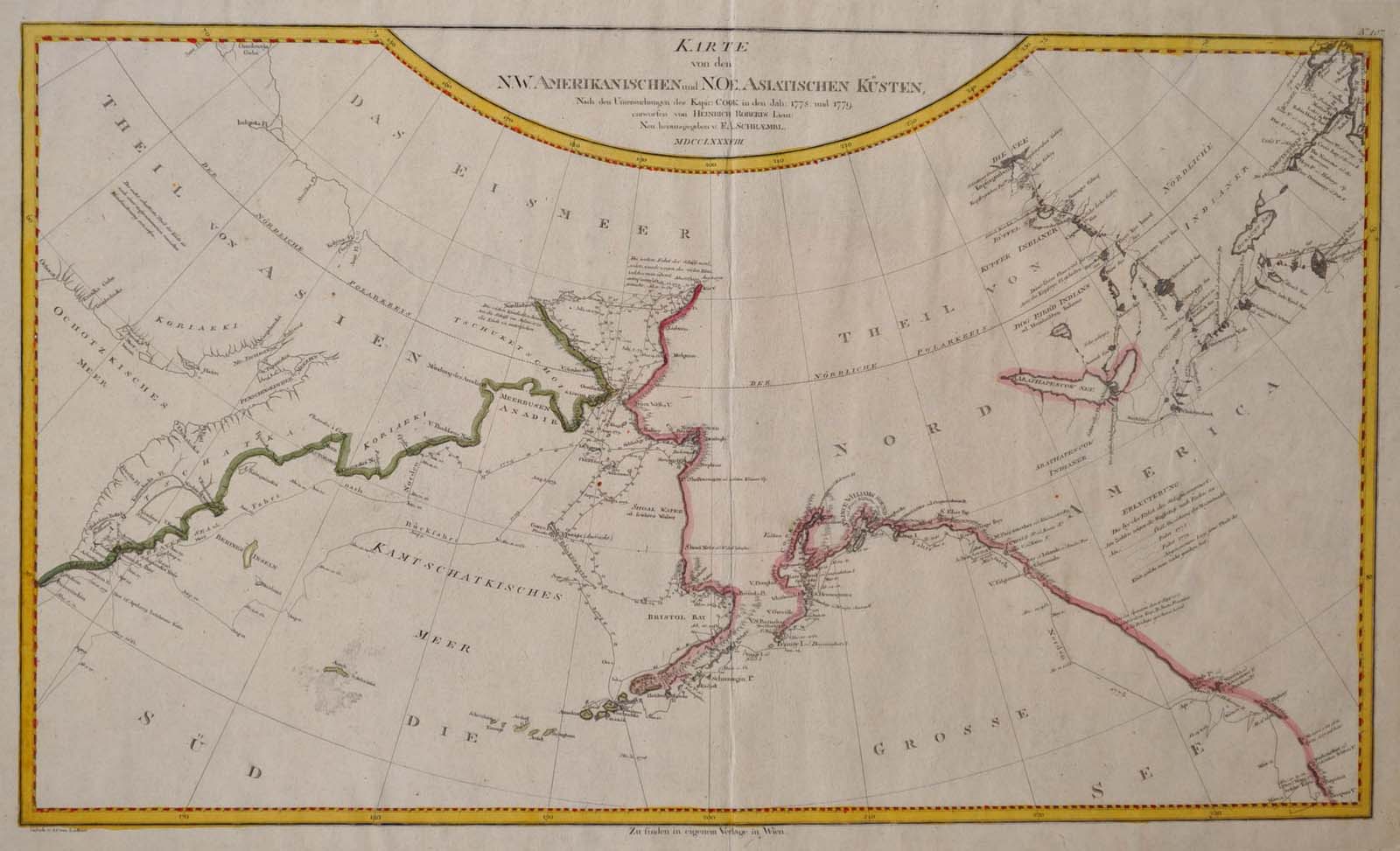
Karte von den N.W. Amerikanischen und N.Oe. Asiatischen Kusten, nach den Untersuchungen des Kapit: Cook in den Jah: 1778 und 1779. entworfen von Heinrich Roberts Lieut. [map]
Vienna, Austria: F. A. Schraembl, 1788. First Edition. Unbound. Folio. Very good+ condition. Item #016789
A large map, beautifully decorated with original outline color and a yellow and red border. The NW Coast of North America is shown from below the 50th parallel and north to above 70 degrees latitude. The NW corner of Hudson's Bay is shown and west to 140 longitude, and includes all of Kamtschatka. An early view of the Behring Straits and the Alaskan Archipelago. The map has minor soiling in the image, but is really quite clean and has large margins, which are very lightly soiled here and there.
Price: $425.00
See all items in
Cartography & Maps
See all items by F. A. Schraembl