Cartography & Maps

Nouveau Plan de Paris indiquant les arrondissements et les quartiers ainsi que le percements executes et projetes. [map - carte]
Paris: Dresse par Achinet Alfred Potiquet, 1867. First thus edition. No Binding. Large antique folding map of Paris: measures 39 x 30.5 inches, in 32 sections. Linen backed. Hand-colored lithograph folding pocket map. Hardcover case, impressed by Auguste Fontaine, purveyor. More
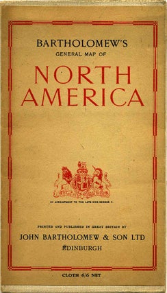
BARTHOLOMEW'S GENERAL MAP OF NORTH AMERICA.
Edinburgh: John Bartholomew & Son Ltd, 1946. Early edition. Paperback. Octavo (8vo). Large linen-backed folding map, with printed wrappers affixed front and rear exposed panels. No date of publication listed, but an advertisement for the Ninth Edition of the Citizen's Atlas of the World for 1947 is on the back..... More
Asia after world war II showing changes to 1950. [map]
Chicago, IL: Rand McNally, 1950. Paperback. Maps;48" x 30"; colored folded wall map; in folder. More
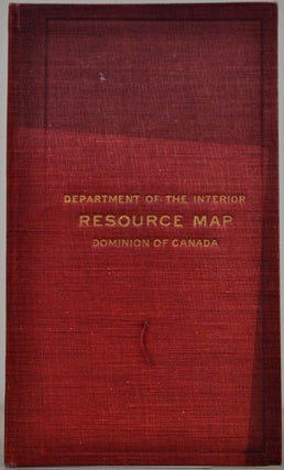
Resource Map of the Dominion of Canada.
Ottawa: Canadian Department of the Interior, 1905. Paperback. 20 pages of text (statistics); red cloth binder slightly darkened; large 11" x 20" colored folded map. Canadiana, Maps. More
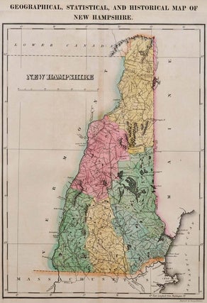
GEOGRAPHICAL, STATISTICAL, AND HISTORICAL MAP OF NEW HAMPSHIRE.
Philadelphia, PA: Carey & Lea, 1822. First Edition. Unbound. 22.25" (width) x 17.5" (height) printed sheet, with 8.75" x 11.75" hand-colored map near center of sheet (five color). Excellent condition, except for slight browning to center fold, which is offsetting from original glue from reverse hinge. Minor browning to margins..... More
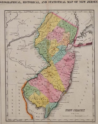
GEOGRAPHICAL, STATISTICAL, AND HISTORICAL MAP OF NEW JERSEY.
Philadelphia, PA: Carey & Lea, 1822. First Edition. Unbound. 22.25" (width) x 17.5" (height) printed sheet, with 9.25" x 11.5" hand-colored map near center of sheet (five color). Excellent condition, except for slight browning to center fold, which is offsetting from original glue from reverse hinge. Minor browning to margins..... More
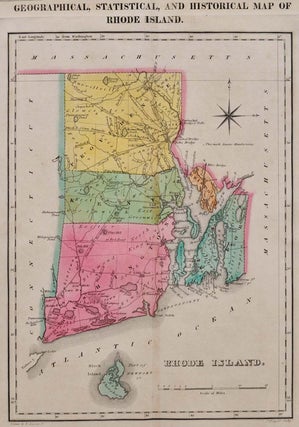
GEOGRAPHICAL, STATISTICAL, AND HISTORICAL MAP OF RHODE ISLAND.
Philadelphia, PA: Carey & Lea, 1822. First Edition. Unbound. 22.25" (width) x 17.5" (height) printed sheet, with 8.25" x 11.25" hand-colored map near center of sheet (five color). Excellent condition, except for slight browning to center fold, which is offsetting from original glue from reverse hinge. Minor browning to margins..... More
GEOGRAPHICAL, STATISTICAL, AND HISTORICAL MAP OF THE WEST INDIES.
Philadelphia, PA: Carey & Lea, 1822. First Edition. Unbound. 22.25" (width) x 17.5" (height) printed sheet, with 15.5" x 12.25" hand-colored map near center of sheet (four color). Nice condition, except for slight browning to center fold, which is offsetting from original glue from reverse hinge and overall minor browning..... More
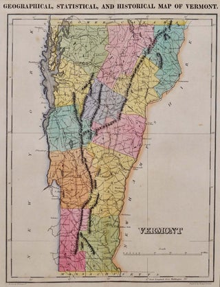
GEOGRAPHICAL, STATISTICAL, AND HISTORICAL MAP OF VERMONT.
Philadelphia, PA: Carey & Lea, 1822. First Edition. Unbound. 22.25" (width) x 17.5" (height) printed sheet, with 9.25" x 12" hand-colored map near center of sheet (five color). Excellent condition, except for slight browning to center fold, which is offsetting from original glue from reverse hinge. Minor browning to margins..... More
![Item #009569 Colton's Delaware, Maryland, Virginia and West Virginia. [map]. G. W. Colton](https://kurtgippert.cdn.bibliopolis.com/pictures/009569.jpg?width=320&height=427&fit=bounds&auto=webp&v=1477439823)
Colton's Delaware, Maryland, Virginia and West Virginia. [map]
New York: G. W. Colton, 1888. First thus edition. Hardcover. 16mo. Folding map measures 18 x 27.5 inches, housed in the original cloth covers with moderate wear. Tiny breaks at a few folds. Small manuscript detail of the geology of the Blue Ridge Mountains affixed over one portion of the..... More
Africa. [map]
Chicago, IL: Henry S. Stebbins, 1886. No Binding. Maps; matted; 18" x 12"; Africa; inset of northwestern Africa, Morocco, Algeria and Tunis; from Cram's unrivaled family atlas of the world. More
Asia. [map]
Chicago, IL: Henry S. Stebbins, 1886. Unbound. Maps; matted; 18" x 12"; continent of Asia; insets of Jerusalem, Canton and Delhi; colored; from Cram's unrivaled family atlas of the world. More
Austria. [map]
Chicago, IL: Henry S. Stebbins, 1886. Unbound. Maps; matted; 11" x 8 1/4"; colored; from Cram's unrivalled family atlas of the world. More
China. [map]
Chicago, IL: Henry S. Stebbins, 1886. No Binding. Maps; matted; 18" x 12"; China; colored; from Cram's unrivaled family atlas of the world. More
Dakota. [map]
Chicago, IL: Henry S. Stebbins, 1886. No Binding. Maps; matted; 18" x 12"; North and South Dakota; 18" x 12"; colored; from Cram's unrivaled family atlas of the world. More
Florida. [map]
Chicago, IL: Henry S. Stebbins, 1886. Maps; matted; 10" x 12 1/4"; colored; from Cram's unrivalled family atlas of the world. More
France. [map]
Chicago, IL: Henry S. Stebbins, 1886. Maps; matted; 11 3/4" x 9 1/4"; colored; from Cram's unrivalled family atlas of the world. More
Ireland. [map]
Chicago, IL: Henry S. Stebbins, 1886. Maps; matted; 8 1/4" x 10 1/4"; colored; from Cram's unrivalled family atlas of the world. More
Louisiana. [map]
Chicago, IL: Henry S. Stebbins, 1886. Maps; matted; 12 1/4" x 9 3/4"; colored; from Cram's unrivalled family atlas of the world. More
Map of the United States.
Chicago, IL: Henry S. Stebbins, 1886. No Binding. Maps; matted; 18" x 12"; United States; colored; from Cram's unrivaled family atlas of the world. More
Montana. [map]
Chicago, IL: Henry S. Stebbins, 1886. Unbound. Maps; matted; 18" x 12"; Montana; colored; from Cram's unrivaled family atlas of the world. More
![Item #8388bam Nebraska. [map]. George F. Cram](https://kurtgippert.cdn.bibliopolis.com/pictures/8388bam.jpg?width=320&height=427&fit=bounds&auto=webp&v=1421170428)
Nebraska. [map]
Chicago, IL: Henry S. Stebbins, 1886. Maps; matted; 12 1/2" x 9 1/2"; colored; from Cram's unrivalled family atlas of the world. More
New Hampshire & Vermont. [map]
Chicago, IL: Henry S. Stebbins, 1886. Maps; matted; 9 1/2" x 10 3/4"; colored; from Cram's unrivalled family atlas of the world. More
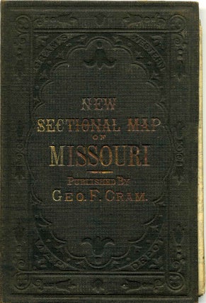
NEW SECTIONAL MAP OF MISSOURI.
Chicago: George F. Cram, 1878. Early edition. Hardcover. 24mo - over 5" - 5¾" tall. Beautiful folding map of Missouri, printed in 1878, a reprinting the 1872 impression. Original brown protective case with minimal shelfwear, remaining quite clean and bright. The interior Census paste-down page is clean and bright; minor..... More